Shark Observatory
Also known as نقطة مراقبة القروش; Ras Mohammed Wall
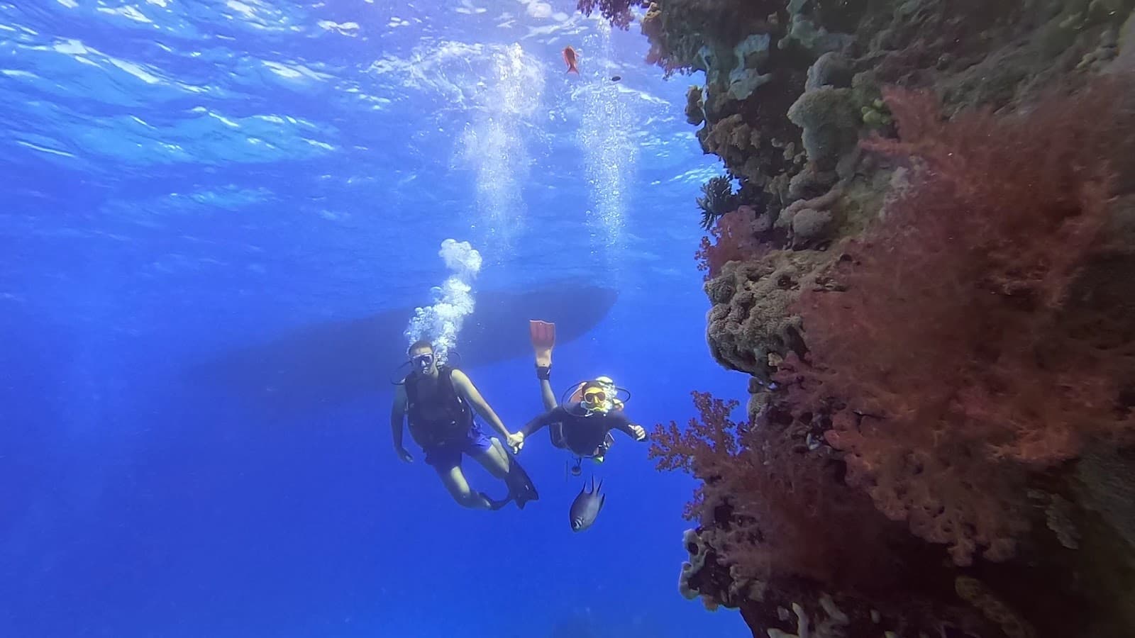
Sheer soft-coral wall dropping past 90 m below the clifftop shark-watching observatory, riddled with caves and overhangs
No detailed dive map yet
A close-up reef map of Shark Observatory will appear here when available.
Sheer soft-coral wall dropping past 90 m below the clifftop shark-watching observatory, riddled with caves and overhangs. Runs south into Anemone City. Day boat; variable current. Inside Ras Mohammed National Park: declared 1983 by the Egyptian Environmental Affairs Agency, 480 km2 (135 km2 land, 345 km2 sea).
Highlights
- Sheer soft-coral wall dropping past 90 m below the clifftop shark-watching observatory, riddled with caves and overhangs
- runs south into Anemone City.
Marine life
- glassfish
- hatchetfish
- red-mouth grouper
- trevally
- jack
- barracuda
- turtle
- reef shark
- gorgonian sea fan
Good to know
- Protected status
- Inside Ras Mohammed National Park: declared 1983 by the Egyptian Environmental Affairs Agency, 480 km2 (135 km2 land, 345 km2 sea).
- Fees
- Ras Mohammed National Park entry fee; Emperor Divers quotes EUR 5 per diver per day for park sites (marine-park fees quoted at EUR 5-7/day).
Dive centres in Sharm el-Sheikh
Centres that run Shark Observatory and the reefs around it.

More sites in Sharm el-Sheikh, Ras Mohammed & Tiran
Amphoras
Sloping reef strewn with the amphora cargo of a wrecked Ottoman-era vessel
Anemone City
Dense carpet of sea anemones and territorial anemonefish on the shallow shelf at the southern end of the Shark Observatory wall
Beacon Rock
The beacon-marked southern corner of Sha'ab Mahmud
Eel Garden (Ras Mohammed)
Gently sloping sandy plateau with a V-shaped stream of sand issuing from a small cave